It was an incredible trip!
Here are some of our favorite photos from the trip (each photo is a thumbnail linked to a higher quality picture.):
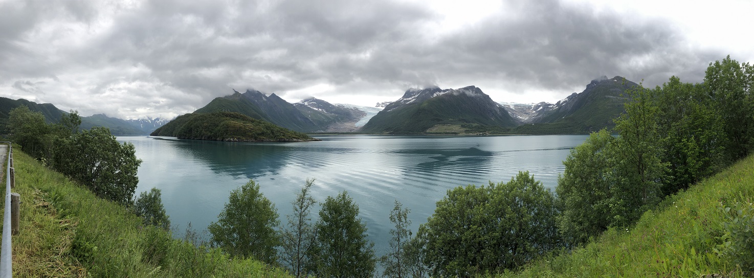
66) After our trip out to Myken we returned to the mainland and resumed our trip north on the scenic E17 Tourist Route. Just like our time in the fjords of southern and central Norway the landscape up in the north is vertical! 2,000 foot tall emerald pillars and cones jut straight up out of the water. The 3,000+ foot high snow-covered mountains that are a backdrop to this are home to the Svartisen glacier which tumbles down multiple valleys which are visible from the road. We stopped at a pull-out along the Glomfjorden to eat lunch and to take a nap. In the afternoon we reached the end of the E17. This road was well worth the three and a half days we spent driving it! The scenery was just breathtaking around every curve! We ended our day in a free parking area at a trailhead over looking the city of Bodø. We even took advantage of the hiking trail to go out for a short walk and to enjoy seeing the magnificent scenery from a higher vantage point!
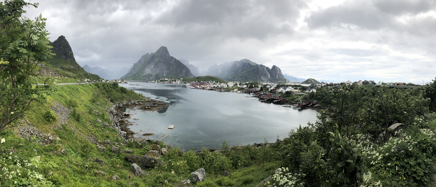
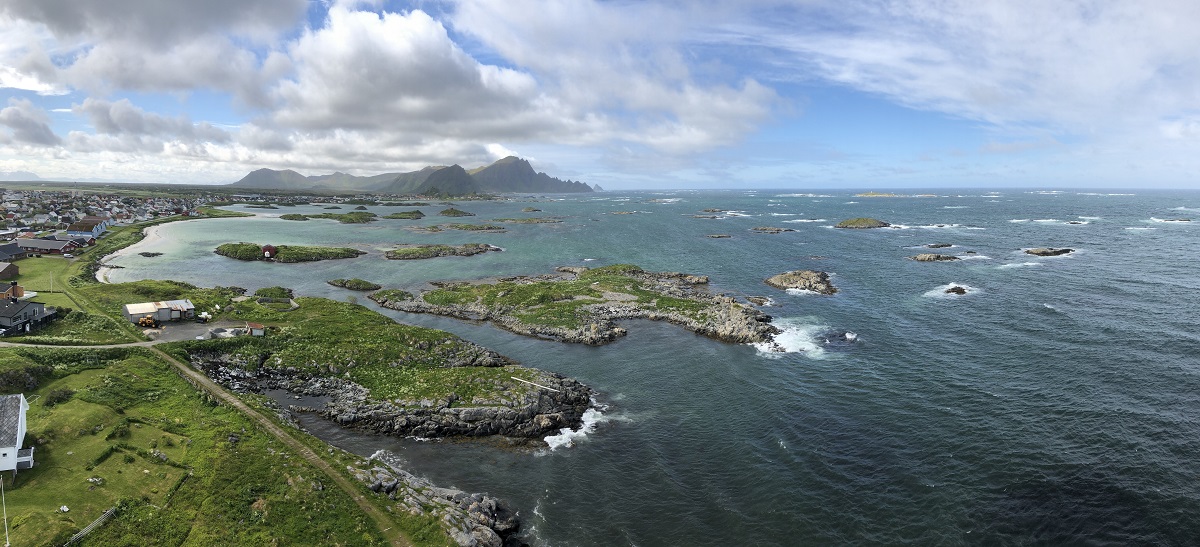
67) We were up really early and then, after a quick ten minute drive, straight onto a ferry for the three hour trip out to the Lofoten islands. Honestly, there are a ton of tourists on this island chain and especially in the tight confines of the southern islands it does feel like too much but this place is just so ridiculously beautiful that is just doesn’t matter. It rained all day and this place is so ridiculously beautiful that didn’t matter either. Driving off the ferry into the cloud-shrouded, emerald green mountains was like going through a time portal to a primordial land - albeit doing so with about 2000 campers, tour buses and luxury cars. The town of Reine was one of our first stops and it was beautiful with colorful houses and rocky peaks jutting up into the sky as a backdrop.
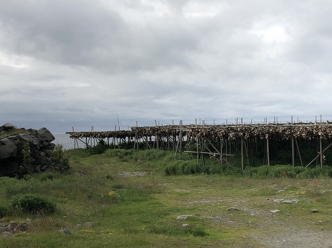
68) After Reine we started driving north and struck out on the first few things we wanted to see - the parking for a beach hike we wanted to do was full and a historic fishing village was charging admission (yes, admission...to walk around a village...nope!) But again it just didn’t matter...just driving around on Tourist Route E10 trying to see things was awesome. Many of the little villages in the Lofoten Islands were historically cod fishing villages and many still have extensive fish drying racks that were used to dry cod for a few months before it was packed and shipped.
69) Finally, we hit on something interesting when we headed down a side road and found a glass workshop - the Glasshytta på Vikten. We sat for 45 minutes watching a glass blowing master do incredible things with molten glass. We both left impressed and inspired.

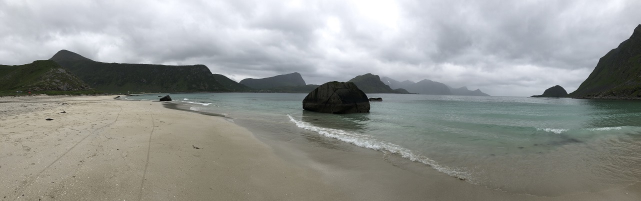
70) Next we found a beach with parking and went out in the cold rain to enjoy the view. Rain, schmain, the scenery was well worth it. A white(-ish) sand beach with gigantic lush cliffs looming overhead.
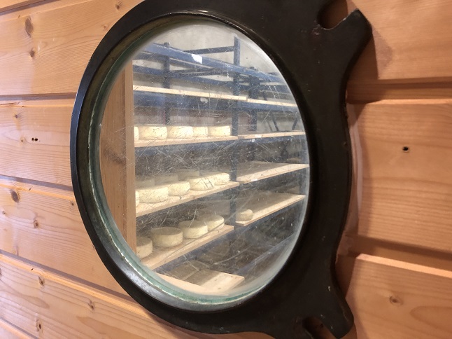
71) We had lunch in the van watching waves just out the windows crashing on rocks and rolling up the wide sandy shore. We continued making our way north stopping a couple of times along the way to see an organic farm and a bird viewing tower at a marsh. We had a nice tour of the Aalan Farm organic goat farm in Bøstad and bought some of their cheese which is aged in-house.
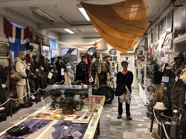
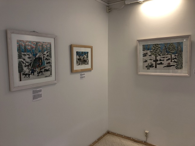
72) In the late afternoon we arrived in Svolvær which is the largest city on the island chain. We ended up spending a few hours in this sleepy (and yes, still rainy) town. We visited an gallery space where a group of local artists display, looked in the window of a few artists’ personal galleries and, best of all, visited the Lofoten Krigsminnemuseum - a great WWII museum that is well worth a visit. It was nearly 8pm by the time we called it quits in Svolvær so we drove for a bit more on the E10 until we found a free parking area right on the shore of Hadselfjorden with cloud covered, snow-laced mountains hanging over our heads.
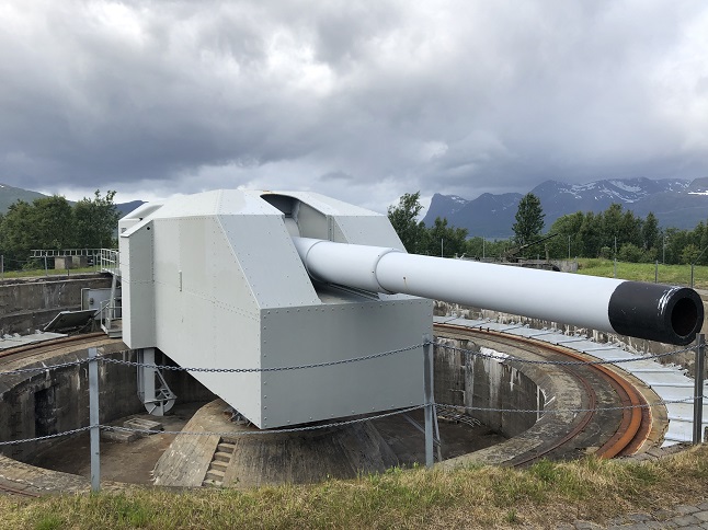
73) We officially left the Lofoten islands today and moved into the Vesterålen chain of islands but the distinction is political more than geographic. From a scenery perspective it is still the same: lots of big mountains, lots of very deep fjords and a coastline that seems to go on forever. Our main goal today was to get up to the northern-most point of this chain of islands but we chose to take a roundabout route. The rain broke in the early morning so we took advantage of actual sunlight and blue skies to see some of the landscape that we couldn’t see last night - stunning! We continued driving on the Tourist Route E10 and it continued to live up to the scenic route designation. There were just too many "wow" moments to specify any particularly nice spots here. Our target for mid-day was Trondenes. This area was a critical one for the Germans during WWII because of the iron ore shipped out of Narvik on the mainland. A massive gun battery was built in Trondenes by Russian POWs and it was was armed with four giant 16” battleship cannons. A museum has been built around one of the guns... which is in the middle of an active Norwegian Navy base and is only accessible via a guided tour. It was interesting and would have been a great 30 minute tour but unfortunately it actually took one hour and forty five minutes - we both thought it was excruciatingly boring. After that we skipped the free walking tour of the old POW grounds (mostly just foundations now anyway) and beelined it west. We ferried, drove over bridges and drove through tunnels to island hop our way over to the island of Andøya. Here we found the Andøya Tourist Route - yup, this makes *two* scenic routes in one day. The rain resumed in the mid-afternoon and turned into squalls once we were on the west coast - this is right on the shore of the Norwegian Sea and if you head west the next thing you hit is something like the Northwest Passage in northern Canada - yup north even of Greenland - so the weather changes quickly as it blows across the north Atlantic. For the evening we found a campground right on the beach and even went out for a cold and windy walk during a brief window of clear sky in between bands of rain clouds.
74) We had another big transit day today as we moved off the islands and back onto the mainland. It was a short drive to Andenes which is at the very north end of the Lofoten/Vesterålen island chain. Given all the mountains it was a surprise to find the last town out on a flat plain! Because of the flat land this is also home to a military air base and Norway’s rocket launch facility! It is also home to more radar and radio towers than I have ever seen on one island! Anyway, we had a couple of hours to burn so we took a tour up the local lighthouse - which, at 41m, is the fourth tallest in Norway. The view from the deck at the top was well worth the price of admission though the wind threatened to help us descend via the direct route. We managed to cling to the sparse railing and crawl back in the door before we were sent flying out over the airport.
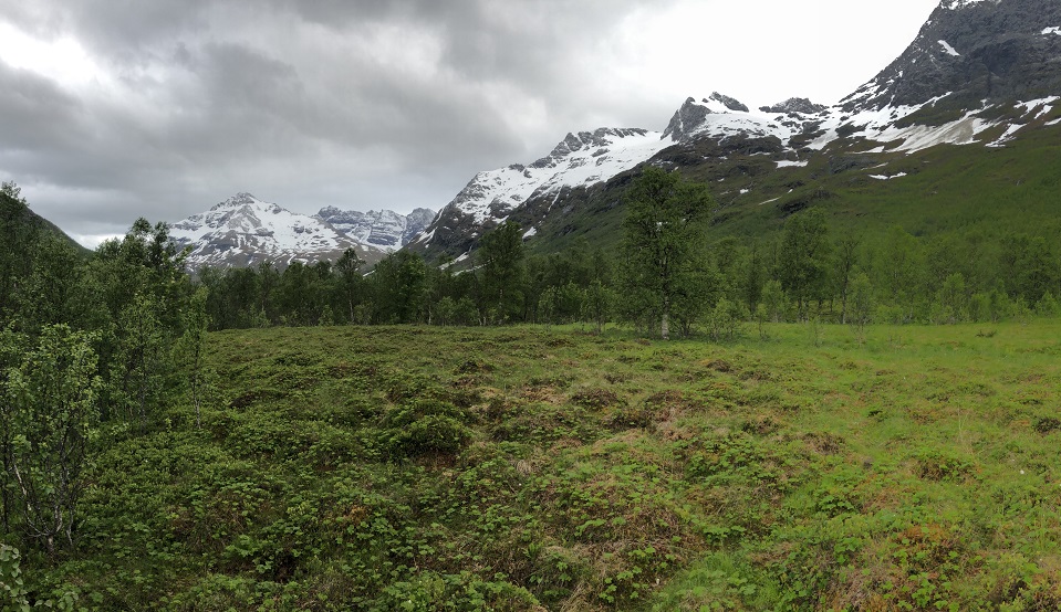
75) We boarded a one hour, forty five minute long ferry that took us back to the mainland. Thanks to a strong swell it was a rollercoaster ride for about half of it. The ferry was getting lifted about half its height and then rolling down the backside of the swells while skewing about 30 degrees off course. Wheee! Once back on steady ground in Senja we immediately turned onto another Tourist Route - Tourist Route Senja. Once again we were in very dramatic scenery that ticked all the Norway highlights - stunning mountains, rocky coastlines, quaint villages, waterfalls, lakes, etc. Yes, I know I am a broken record on all this but it just doesn’t stop being spectacular. Trust me, if even a few miles was boring and ugly *that* would make the highlight reel for the day just because it would be different! What did change, once we left The peninsula of Senja and started north towards Tromsø was the mountains. The area about 100 km south of Tromsø starts to get higher in altitude, with bigger mountains, more snow and just generally more rugged. We stopped for the night just short of Tromsø but in terrain that feels like we are back home...well, sort of... all the moisture and swampy tundra on the ground doesn’t fit with the Colorado mountain look.
76) Our day in the Tromsø area was split into two halves. For the first half we got up, had a quick breakfast and then drove into misty Tromsø to check out the city. Our first stop was the tourist information office but they were mainly geared up to deal with the cruise ship that was docked right outside the door so after using their wifi we ventured out to find the nearby Northern Norway Art Museum. It was a very nice mix of art and was focused, as the name says, on artists from the north of Norway. Very well done and they had complementary tea and cookies so they are now high up on our list of favorite art museums from this trip.
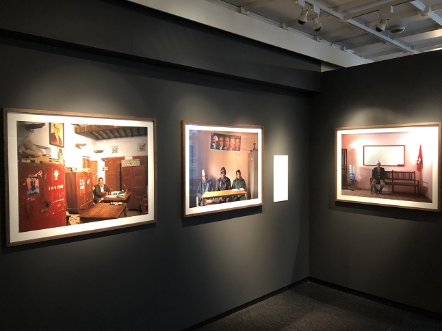
77) We walked out their door just as the grey skies opened up but we still made the walk across the downtown to visit the Perspektivet Museum - a photography museum. Wow! Thus museum is smaller than the photography museum we visited in Stockholm but impressed us just as much. We found both the Jan Banning exhibit "Red Utopia" and the Knut Stokmo exhibit "Gatelangs Med Fotograf Knut Stokmo" to be excellent. We didn’t ask about tea and cookies but this one is a strong candidate for best of the trip!
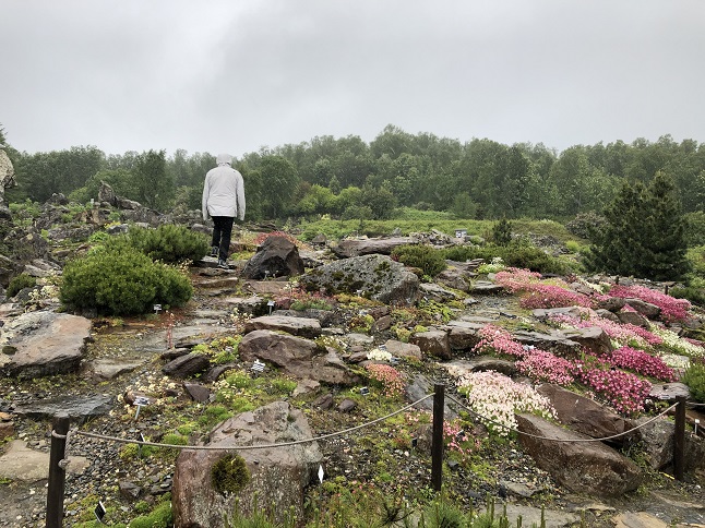
78) The rain was even harder when we left Perspektivet and even with our rain jackets and hats we were soaked when we sloshed into a cafe for lunch. We drove to the north end of the city and visited the university’s Arctic–Alpine Botanic Garden - one which specializes in tundra and high altitude plants from around the world. The wind and rain had beaten up their flowers but I really enjoyed their collection of micro-succulents. Just palm sized rock pockets on a head high rock wall with teeny tiny plants in each one. It was a microscopic version of a flower garden. With sprinkles still falling from low laying clouds we scrapped our plan to ride a gondola to the top of a nearby mountain - the view would have just been the inside of a cloud. We liked what we saw of Tromsø. The two surprises for me were 1) this is a big city to be this far north and 2) were the engineers just showing off with all the tunnels? Multiple roads drilled through a big mountain with multiple round-a-abouts *inside* the mountain? Really? Honestly, either the road engineers are mole people or they are just showing up the road crews in every other country. The second half of the day was to drive ever further northward. The theme was the same - mountains, waterfalls and fjords. We ended our day free camping on a pier area of the Reisafjorden in the village of Sørkjosen.
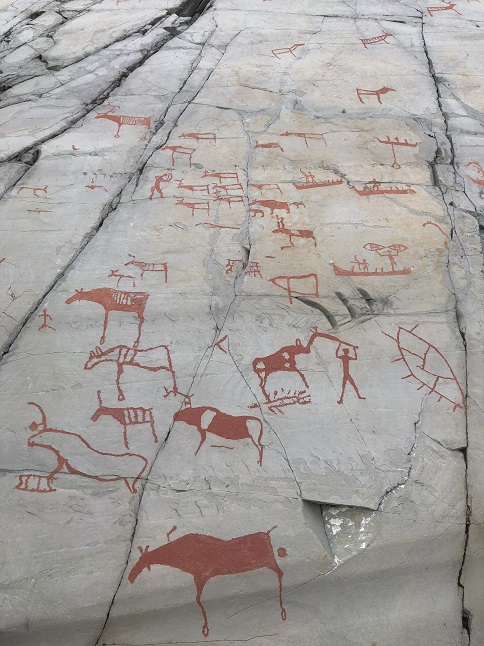
79) The day started with rain but it began to clear up while we were having breakfast. We got moving early and drove north to the little village of Alta. The drive along Altafjorden was more beautiful fjord driving but the mountains were back to being much lower in height and without snow on top. We are pretty far north now and tree-line is humorously low (for someone from Colorado). We drove over a low hill at one point today and rose above tree-line! Anyway, our reason for heading to Alta was to see the UNESCO World Heritage site there that protects stone age rock carvings. With blue sky finally overhead we got out and walked the 3 km long boardwalk to see all 22 official rock faces that are marked with carvings. Very cool stuff! The rocks were originally red and at sea level when they were carved over a long period between 7,000 and 3,000 years ago. As the ice age gradually ended and over time the ice melted the land rose up without the weight of the ice on it so the carvings are dated based on how high they are above sea level with the oldest being the highest. The rocks sun bleached grey/white so now the carvings are faintly visible. On a few of the rocks they have colored in the carvings to make them more obvious. Anyway, it was fascinating to see them, to read the interpretations by archeologists and to ponder the bigger questions around creating art.
80) We finished up by looking around the museum, ate lunch in the camper and hit the road. For the first time in weeks we didn’t continue north! It was 6 hours to the north cape and we instead headed east into the Finnmark. This also took us away from the coast for the first time in weeks. No more dramatic mountains, no more fjords, no more scenic islands and quaint fishing villages and spectacular waterfalls. Instead the Finnmark is a huge scrub forest with rounded hills and meandering rivers. This is the land of the Sami - the European indigenous "eskimos". The land of giant reindeer herds and many lakes and massive swarms of mosquitos. In the winter it is the center for nordic ski’ing, dog sleds and snowmobiles. We drove for 200 kms through the same stunted forest with the tallest trees being barely the height of our camper. We stopped for the night in Karasjok which is the capital of the Norwegian Sami culture.
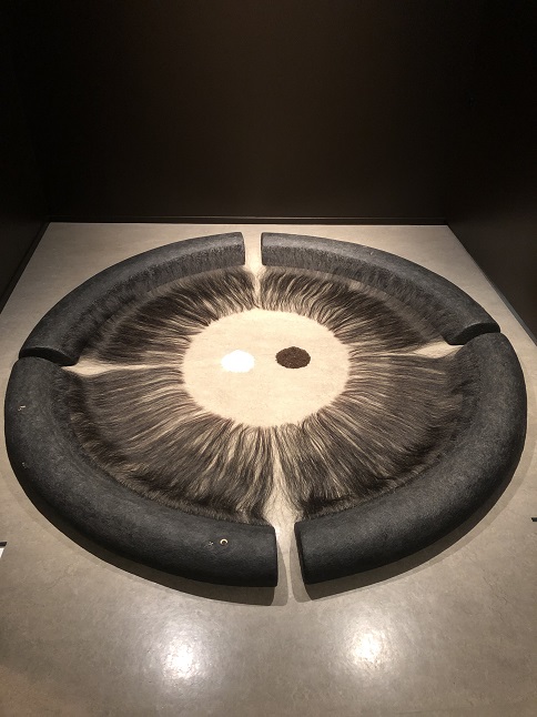
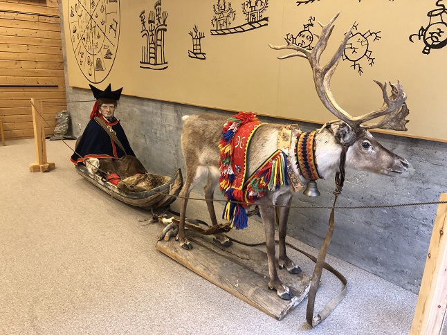
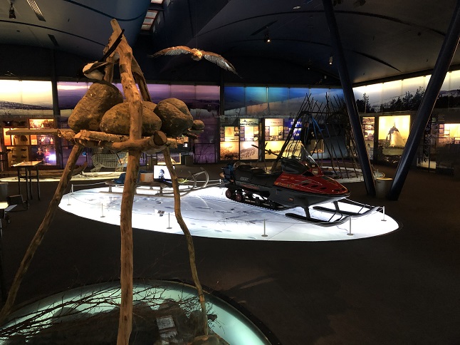
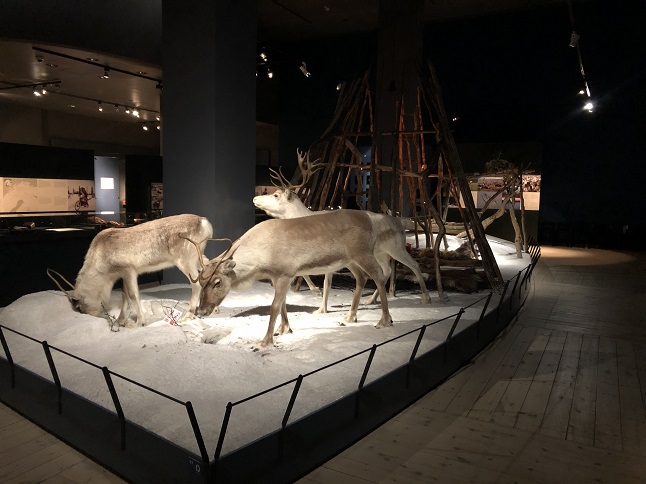
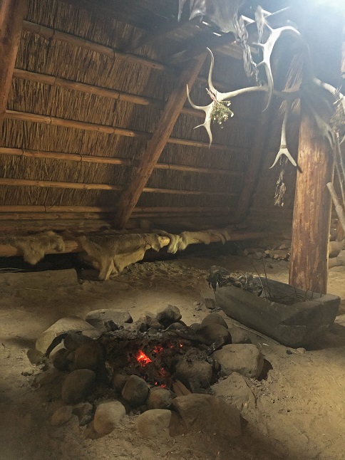
81) This is the day we did a cross-border deep dive into the Sami culture, history, art, craft and architecture. The Sami are the indigenous people of Northern Europe and have historically been nomadic reindeer herders, fisher people and hunter-gatherers. The creation of the borders for the countries of Russia, Finland, Sweden and Norway have fragmented the traditional grounds for the Sami. Finally, in all of these countries both religious and political efforts were made over a multi-century time period to eradicate much of the unique Sami culture (queue up the story of the indigenous people all over the world...) We started our day by visiting the Sami Museum in Krasajok, Norway where we saw exhibitions on Sami clothing, spiritual beliefs, reindeer herding, fishing, and handicraft.
82) From there we drove across the border into Finland and left the scrub birch forest of the Norwegian Finnmark and moved into the pine belt of northern Finland. We stopped mid-day in the town of Inari, Finland to visit the Siida Sami Museum. This museum covers most of the same material, as well as telling the geologic and political story of northern Europe. This was a much better funded museum with much fancier displays. They also provided a lot more detail on the Sami including talking more about the current Sami culture. Both museums also had open air collections of Sami buildings from the 1800s and early 1900s so we could get an idea of how Sami people lived after they left their nomadic lifestyle. Very interesting and I have a lot to think about now both about the Sami but also indigenous people everywhere.
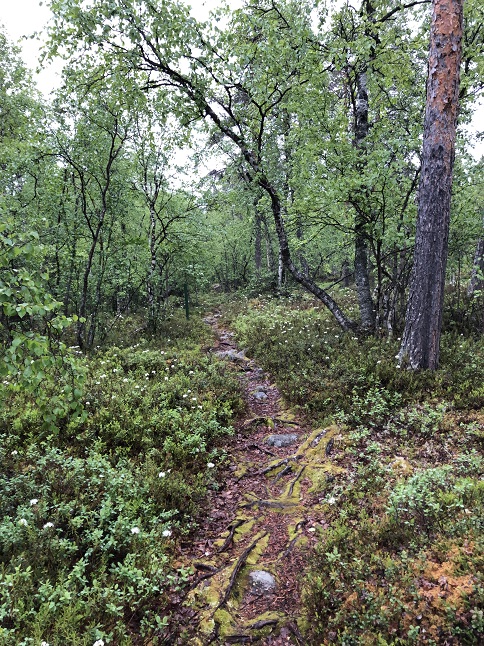
83) A very helpful gentleman in the Inari Tourist Information office pointed us to a free camping spot just out of town along the Juutuanjoki River where we settled in just as the evening rain started to fall. We did a short hike but the swarms of mosquitos meant we couldn't stop to enjoy the views so we quickly returned to the safety of camper-van.
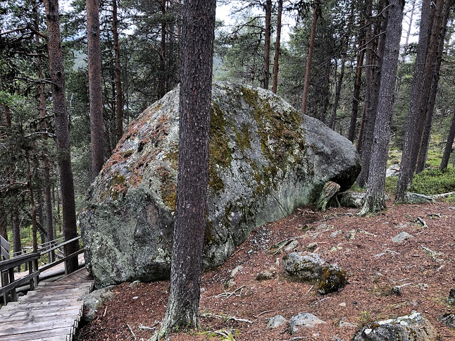
84) When we woke up the forecast was for intermittent rain so we decided to forego any of the primarily outdoor activities in the Inari area and to make our way south instead. Our first stop was at Karhunpesäkiv (Bear’s Den Rock) which is a tafone. A tafone is basically a hollow rock - in this case a dump truck sized boulder that has flaked apart from the inside so that you can crawl under the lip and stand up inside. Strange and cool.
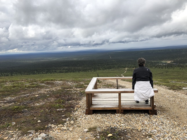
85) We had planned to spend the day exploring the area around the town of Saariselkä but when we got there we discovered that it is a winter destination and basically closes down completely in the summer. Instead, we continued south and since the morning sprinkles had abated we made a side detour to Kiilopää where we hiked into Urho Kekkonen National Park to the top of Fell Kiilopää. From the top of the mountain (well, more of a hill to my eyes) you can look eastward to the Russian border and westward to the Swedish border.
86) After lunch and a nap in the camper we pointed the wheels south again and, under lovely blue skies, continued to Sodankylä. We stopped in at the local tourist information office and discovered it was also the Museo-Galleria Alariesto. This is an art museum dedicated to the work of the Finnish husband and wife team of Andreas and Rikka Alarieston who were mid-20th century folk artists and story-tellers. The art and descriptions focused on the life of northern Finnish people, both Sami (controversially called Lapps in the descriptions) and Finns. We both enjoyed the art - a great surprise find!
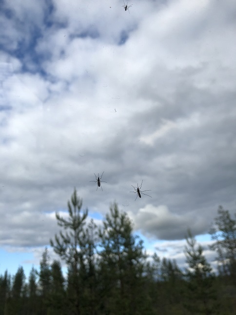
87) In the evening we drove another hour south and found a free camping spot in a pull-out off a side road. The mosquitoes here are unreal - we are basically trapped in the van with literally dozens of mosquitos lurking on the outside of all the windows! Queue the Jaws theme song.
88) After nearly a week in the stark lands of the north we spent today soaking up the sights of a city - a real city. Not a village or a small town but an actual city. The first one we have seen since Tromsø, Norway. We managed to survive the mosquito encirclement of last night and left the peat bog marsh area we have been driving through to enter the lakes and rivers around Rovaniemi. Specifically, this city was built where two large rivers meet. We parked and hit up the tourist information office. We bought a culture pass that provided access to three different museums and then walked to the Arktikum Arctic Science Museum. As the name says this museum focuses primarily on the arctic region covering all northern latitudes across Europe, Asia and North America. It touched on a wide range of topics - the effects of climate change, the loss of indigenous people’s culture, specialization of arctic animals and the aurora borealis. However, there were a lot of other exhibits as well - Finland’s history as a new country from 1917 to the present, the loss of the Petsamo region to Russia after WWII and a scientific study of the peat mires of central Finland. It was a huge amount of information so we were happy to take breaks in the two auditoriums to space out and watch pretty films about the aurora and the polar sun cycle.
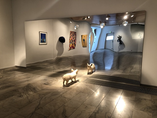
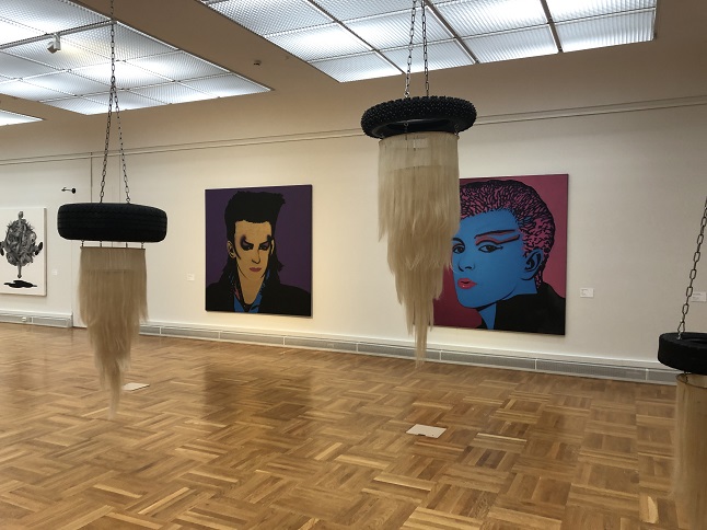
89) We ended up spending over two hours in the Arktikum so next we stumbled back to the center of town and in brain overload made our way to a Mexican restaurant to get burritos. We had low expectations but were pleasantly surprised to get good burritos this far from home. Next we headed to the Korundi House of Culture - the city’s contemporary art museum. Our parking time was running out so we rushed through faster than we normally would but still enjoyed it. Some pieces provoked thought but there were also a few that were just fun to look at and others that just didn’t do it for us.
90) We thought we were done and were packing up to leave when we found an ad for a summer bobsled run at the nearby ski mountain. In an area where nearly everything is winter focused this seemed like a way to tap into at least a little of that. It was fun - basically an open topped metal pipe with a chair shaped skate board. It was a 500 foot drop in elevation so gravity provided enough speed that having a brake was necessary. Wheeeeee.... Finally, we stopped at a flea market on the way out of town to look around - nothing particularly interesting just the same stuff as any other flea market only in Finnish. Having "done" Rovaniemi we rolled out of town heading south and found a nice free camping spot on the shore of a water reservoir. A nice view and fewer mosquitoes than the past few nights.
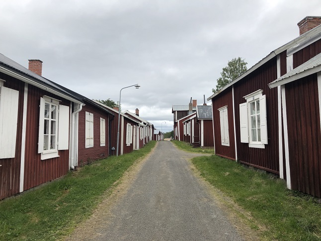
91) We woke up with a decision to make: do we go south along the west coast of the Gulf of Bothnia through Sweden or along the east coast through Finland? Both routes seemed to have interesting things to see and in the end we split the difference. First we made the drive from our camping site to the north shore of the Gulf. Then we headed west into Sweden to Gammelstads Kyrkstad - the old church village of Luleå. This is a UNESCO World Heritage site and it has a fascinating story with geology, politics, religion and local culture all playing a part. We signed up for a tour with an official guide and ended up with a private tour when no one else signed up. Our guide was excellent and told us all about the story of this area from the 15th century to the present. After lunch in the camper we reversed course and drove back east to Finland. From there it was a long drive south along the coast to the city of Oulu. We found a free parking lot on a small island dedicated to sports fields and play grounds that is just a short walk from the main museums. A perfect location from which to to explore the city. After dinner we did a short walk over some of the many bridges that connect some of the islands that make up the city and really liked the feel of what we saw. We were once again south of the Arctic Circle so at night the sun finally set for the first time in a couple of weeks.
92) We have to be honest with you we have a bit of a city crush on Oulu. We spent today seeing the city and we liked what we saw. First of all the downtown area is spread across a river delta covering the two river banks and a half dozen small islands. The are a lot of green spaces, an extensive network of bicycle trails, a busy public market square, a handful of museums, lots of free parking and water everywhere. We headed out on the bicycles in the morning to find the art museum. It turned out to be a nice contemporary museum with three exhibition spaces. Nothing blew our minds but it was interesting to look around.
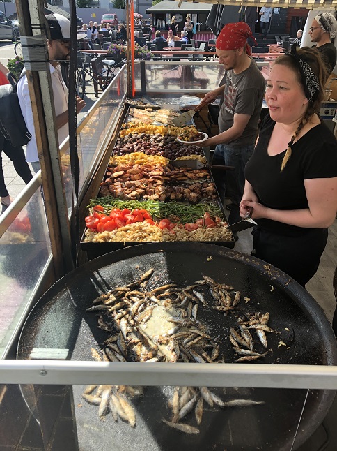
93) We purchased a city culture pass that provided entry to eight different museums so since it was now free we went across the street and visited the Oulu Science Museum. This was definitely a kid’s museum but I guess we are kids at heart because we had a lot if fun playing with all the interactive displays. Only about half of the exhibits had full english translations so there were definitely details we missed but I think we got the gist of everything. With all these great parks and bike paths we explored as we cycled to the downtown Market Square where a big street food festival was just starting up. Good, cheap international food stalls!?!? Yes, please! We found a Finnish tent serving local meat, fish or vegetable plates. Yum! Better yet, a tent nearby had Italian gelato...just the thing for a warm sunny afternoon.
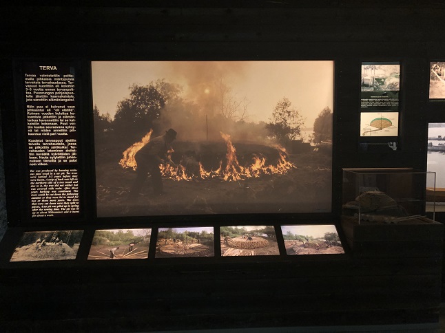
94) Next we cycled over to another island and visited the Sailor’s Home Museum. A wooden house from the 1800s that told the story of Oulu’s strong connection to the sea. It also had a short video about the history of the island which was one of the most concise and informative history lessons I have seen on this trip - very impressive and we know of a few places we have visited in the past few weeks that should hire the videographer! As we cycled back to the camper dark clouds rolled in and it started to sprinkle. After a rest we ventured out into the on again-off again rain to visit a fourth museum - the Northern Ostrobothnia Museum (aka the regional history museum). This was a great museum focused on creating displays that showed a room from a given point in time with all the furniture, decorations, clothes, etc appropriate to that time. There were four floors with displays covering the later period of Swedish sovereignty (1700 & 1800s), Russian sovereignty (late 1800s to 1917), and Finnish independence (1917 to present). There were also displays on the local industries - pine pitch, lumber, ship building, fishing and sailing. Very informative! Next we headed back to the Market Square and took a look in the Oulu City Library before returning to the food stalls for another round of cheap eats...eating two meals out in a row is unheard of for us but the street food festival was that tempting! The rain let up just as were leaving so we pedaled back to the camper the long way - island hopping via the bike paths and enjoying the beauty of the nature preserves that are literally just across the water from downtown. Yup, we have a bit of the old amore for Oulu.
95) We had another busy day that spanned the travel spectrum from art to history to scenic beauty. The day started with us temporarily reversing course to drive back north. We attempted to visit the Oulo Botanic Garden but found it is closed on Saturday. We continued north for about half an hour to the tiny village of Ii were we walked the historic waterfront. It is just a couple of blocks long but contains original wooden fishing houses that date back to the late 18th century. Next we found a public sculpture garden to walk through but found half of it was inaccessible because the river front was closed for snowmobile racing in the river - yes, you read that right. No, the river isn’t frozen and no I don’t mean jet-skis. Snowmobiles ridden so fast that they skim across the top of the water through a slalom course of bouys set up for them to race around. Oh and yes it was as loud as you might expect from a pack of unmuffled two-stroke snowmobiles being ridden with wide open throttles. The hour drive to our next stop gave our ears a chance to recover. To the east of Ii was the Kierikki Stone Age Centre. This is an active archeological site excavating a 5,000 BC stone age village. There is a museum that provides a lot of detail about the history and culture, as well as a recreated village to show what it may have looked like. The museum was very good, the village...well...it was a bit cheesy. Still, the whole thing was free with the culture passes we bought yesterday so definitely worth the visit.
96) After a quick lunch in the camper we turned the wheels south again and resumed our earlier trajectory. The tourist information center in Oulo had recommended we take a look at the Lake Oulujärvi area and specifically the island of Manamansalo. We were ready for a campground to recharge the van batteries, refill water, empty tanks and do laundry so we found one that was highly rated and were quite pleased to see it lived up to the hype - a spacious campground right on the shore of the island with peaceful ponds, hiking trails and lots of trees. We went for a short hike around lovely Särkinen pond, cooked dinner in the empty kitchen and ate looking out on the lake. Around midnight we even had a colorful sunset!
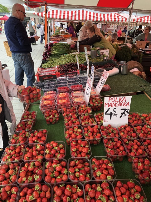
97) We had a day that we split with hiking in Manamansalo National Park and then driving through Finland's lake district to the town of Kuopio. When you look at this area on a map there are large areas where there is more water than land! We found a nice free parking lot right on Lake Kallavesi and had a beautiful lake view straight out the front windshield. As soon as we parked we unloaded the bicycles and went out exploring. The waterfront had a nice sidewalk/bike path along it with a bunch of boats offering lake cruises moored there. We also found an ice cream cart (Yay!) and a cloud burst of rain (Boo!). We did a loop through the main square as well but the whole city is a ghost town on a Sunday evening so we called it a day. The next morning the rain had stopped so we ventured out to see a little more of Kuopio. The town has an old market hall that now houses some specialty/gourmet food sellers. Too rich for our blood. ...but outside a farmers market had set up stalls so we bought fresh fruit and veggies there. Sadly, most of the museums in town are closed on Monday and the weather was too cruddy to do a boat trip on the lake.
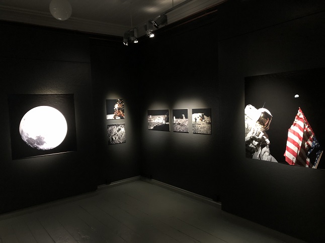
98) We decided to pack up and leave but on our way back to the camper we found a little photography museum that was open. They had a special exhibit on the US Apollo Space Program that was really nice. Large print photos of the astronauts, rockets and missions. We loved it!
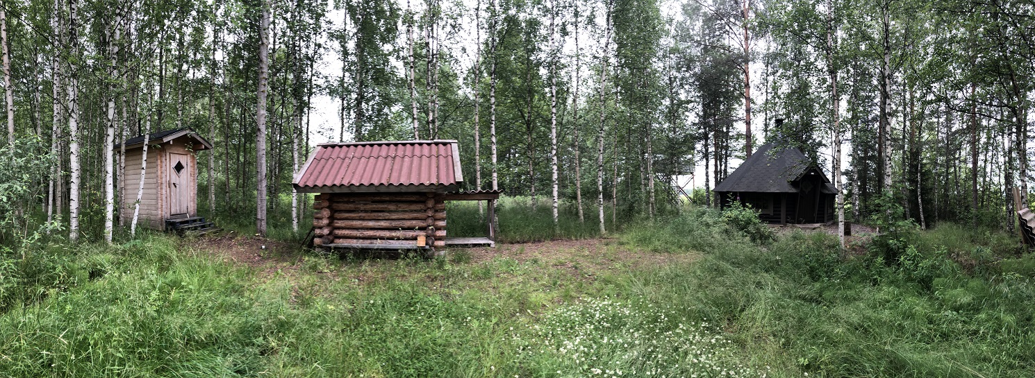
99) We ate lunch in the camper and then pulled up stakes to head further south. After driving for a couple of hours we pulled into a tiny, private parking lot to camp. You know you are in Finland when even the very small parking lot (maybe room for three cars?) for a wetland bird watching tower has a fully supplied and very fancy sauna! We went up the observation tower to do a little bird watching and then returned to the camper to make dinner. We are surrounded by gorgeous silver birch trees and their leaves quiver in the wind just like the aspens back in Colorado so it is a peaceful sound for us that was made all the better by the calls of the waterfowl from the lake.
![]() Go back to the second
'19 Scandinavia Trip Photo Page.
Go back to the second
'19 Scandinavia Trip Photo Page.
![]() Go forward to the fourth
'19 Scandinavia Trip Photo Page.
Go forward to the fourth
'19 Scandinavia Trip Photo Page.
![]() Return to Alan and Jonna's Travel Page
Return to Alan and Jonna's Travel Page
